Hiking At Mt.Longonot
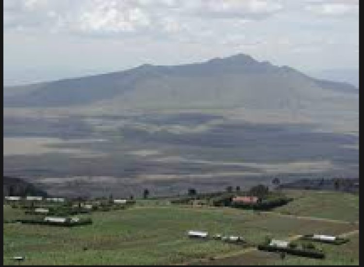
Mount Longonot is a stratovolcano in Kenya's Great Rift Valley, located southeast of Lake Naivasha.
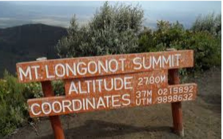
It last erupted in the 1860s, according to legend. Its name comes from the Maasai term Oloonong'ot, which means "many spurs" or "high ridges" in English.
Mount Longonot is located 60 kilometers northwest of Nairobi and is accessible through a paved road. South of the mountain is the Longonot satellite earth station.
I've never considered myself to be a daring traveler. I'm not a big hiker; normally, the only thing that motivates me to go on a hike is the dread of missing out.
It's a beautiful hike, though my first day was terrible because I became horribly unwell.
I paused frequently to choke and vomit as we ascended higher and higher, sweat streaming down my face and my rucksack trying to pull me to the earth — until we arrived at the high altitude teahouse where we'd be spending the night.
I lay on the ground, nearly crying from the physical agony (from the tough trek) and discomfort as the rest of the party went in for tea (from the sickness). I honestly didn't think I could do it at the time.
But then I realized that if I gave up now, I'd never forgive myself for the beauty that surrounded me - the kind of beauty that you can't find anywhere else.
Fortunately, the nausea subsided when I skipped dinner and slept for 12 hours, and I was anxious to embark on this trek.
It was beautiful to see the beauty of mount Longonot in both foggy and sunny skies, as well as the romanticism of clouds with the mountains at night.


